Vector maps of Amsterdam, Netherlands
Amsterdam
A map of area around Amsterdam, Den Haag and Utrecht with major places and roads
Regional-level theme using a style that resembles Google Maps
Map scale: 1 : 100,000
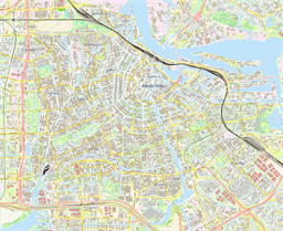
Amsterdam (center), Netherlands
Street-level theme using a modern style with high-contrast colors and uppercase labels
Map scale: 1 : 6,000
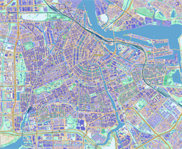
Amsterdam (center), Netherlands
Street-level theme using vibrant colors
Map scale: 1 : 11,000
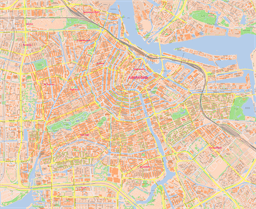
Amsterdam (center), Netherlands
Street-level theme using traditional city-map colors and fonts
Map scale: 1 : 11,000
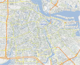
Amsterdam (center), Netherlands
Street-level theme using a style that resembles Google Maps
Map scale: 1 : 11,000
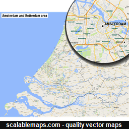
Amsterdam and Rotterdam
A map of area around Amsterdam and Rotterdam with major places and roads
Regional-level theme using a style that resembles Google Maps
Map scale: 1 : 100,000
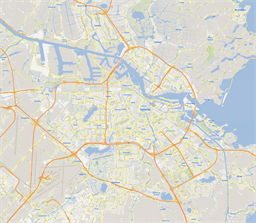
Amsterdam, Netherlands
Metropolitan-level theme using a style that resembles Google Maps
Map scale: 1 : 20,000
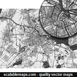
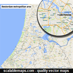
Amsterdam, Netherlands
A black & white, no labels high-detailed map of Amsterdam metropolitan area
Minimalistic black and white theme showing transport network (in multiple layers) without any text labels
Map scale: 1 : 40,000