Vector maps of the World
Continents
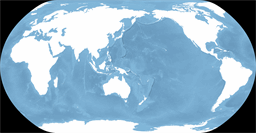
the World
Medium-scale world map centered on east Asia using Natural Earth projection
Theme showing world oceans bathymetry with landmasses masked out in white (raster-only)
Map scale: 1 : 100,000,000
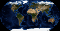
the World
Medium-scale world map using Natural Earth projection centered on Greenwich meridian
Theme showing NASA's Blue Marble land topography and world oceans bathymetry (raster-only)
Map scale: 1 : 100,000,000
the World
Medium-scale world map centered on east Asia using Natural Earth projection
Theme showing shaded relief combined with custom elevation colors based on climate, without ocean bathymetry (raster-only)
Map scale: 1 : 100,000,000
the World
Medium-scale world map centered on east Asia using Natural Earth projection
Theme showing idealized world topography together with vegetation and oceans bathymetry (raster-only)
Map scale: 1 : 100,000,000

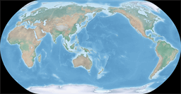
the World
Medium-scale world map using Natural Earth projection centered on Greenwich meridian
Theme showing NASA's Blue Marble land topography, without oceans bathymetry (raster-only)
Map scale: 1 : 100,000,000
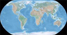
the World
Medium-scale world map using Natural Earth projection centered on Greenwich meridian
Theme showing idealized world topography together with vegetation and oceans bathymetry (raster-only)
Map scale: 1 : 100,000,000
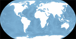
the World
Medium-scale world map using Natural Earth projection centered on Greenwich meridian
Theme showing world oceans bathymetry with landmasses masked out in white (raster-only)
Map scale: 1 : 100,000,000

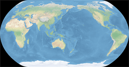
the World
Medium-scale world map using Natural Earth projection centered on Greenwich meridian
Theme showing shaded relief combined with custom elevation colors based on climate and ocean bathymetry (raster-only)
Map scale: 1 : 100,000,000
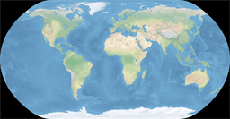
the World
Medium-scale world map using Natural Earth projection centered on Greenwich meridian
Theme showing shaded relief combined with custom elevation colors based on climate, without ocean bathymetry (raster-only)
Map scale: 1 : 100,000,000
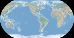
the World
Medium-scale America-centric world map using Natural Earth projection
Theme showing shaded relief combined with custom elevation colors based on climate and ocean bathymetry (raster-only)
Map scale: 1 : 100,000,000