Vector maps of Colombia
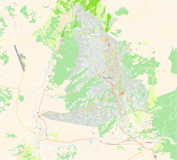
Bucaramanga, Colombia
Street-level theme using vibrant colors
Map scale: 1 : 11,000
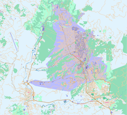
Bucaramanga, Colombia
Street-level theme using a modern style with high-contrast colors and uppercase labels
Map scale: 1 : 7,500
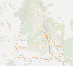
Bucaramanga, Colombia
Street-level theme using a style that resembles Google Maps
Map scale: 1 : 11,000
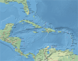
Caribbean
Continent-wide theme showing the physical map with shaded relief raster, country borders and major populated places
Map scale: 1 : 8,000,000
Caribbean
Continent-wide theme showing the physical map with shaded relief raster, roads, railroads, ferry routes, country borders and major populated places
Map scale: 1 : 8,000,000
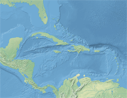
Caribbean
Continent-wide theme showing the physical map with shaded relief
Map scale: 1 : 8,000,000

Caribbean
Continent-wide theme showing the physical map with shaded relief raster and country borders
Map scale: 1 : 8,000,000
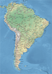
South America
Continent-wide theme showing the physical map with shaded relief raster, country borders, major populated places and roads
Map scale: 1 : 15,000,000
South America
Continent-wide theme showing the physical map with shaded relief raster, roads, railroads, ferry routes, country borders and major populated places
Map scale: 1 : 15,000,000
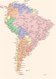
South America
Continent-wide theme showing the important cities and road network
Map scale: 1 : 15,000,000